
Classic boat pic of the approach to Rum

Arriving in Kinloch, hills under the clouds


I liked the campsite washing facility in the foreground.
 This heron appeared everyday. |
 |

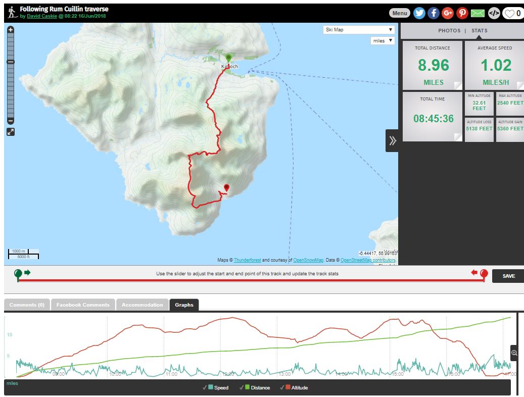
Saturday - forecast suggested this was to be the best day for my Rum Cullin walk!

Loving it.

At this point, after a couple of miles and 1250 feet ascent Sharon decided to sensibly head back, though she still had the swollen river to cross alone!
 |
 Happy to be heading home. |
 |
|

Meanwhile I continued, awaiting the much promised improving weather. About a mile further I got to the top of Hallival.
 Some 20
minutes later, enjoying the splendid views. Some 20
minutes later, enjoying the splendid views. |
 About this point my camera started playing up, so had to switch to the phone camera |

What I should have been seeing. Askival, and the ridge to Trollval, with Ainshval behind.

When I came across this on the ridge I was all for turning back, and giving up on these stupid corbetts for ever.
Of course I didn't. Went left and managed to circumnavigate the Askival pinnacle

Oh, another rocky steep bit. Glad I couldn't see more.
 Approaching
the top of Askival
|
 |

First corbett of the day done. Only 4 miles, but four hours down.

More spectacular scenery.

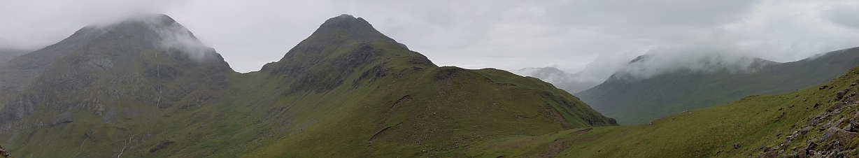
At last, a bit of a view, after quite a hairy descent. Just above the Bealach an Oir, looking to hill three - Trollaval, with Ainshval in the cloud to the left of the Beallach an Fhuarain .

And looking down Glen Dibidil. Bothy down there by the sea.
Still a good bit to go. Up Trollaval then left to Ainshval.

And where I have been - just done all that

Cloud finely clears from Ainshval and Sgurr nan Gillean.

From the top of Trollaval looking to Ainshval and Eigg.

Hallival and Askival tops now cloud free.
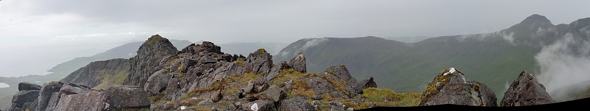
Got a bit of a view north too, over the western top of Trollaval. There was some exposed scrambling to get these, so I didn't. Harris Bay on the left (see later cycle trip), and Barkeval on the right (I think)

And finally, the top of Ainshval, as the cloud closed in again, and my phone battery started to die. Oh dear, back to map reading shortly!

And so off into the mist, no camera, no phone, no view. Six miles done, nearly seven hours gone, only another two and a half miles to the bothy over two
more hills, then six miles back up the Dibidil track to home, with a further 1000 feet of ascent. Going to be late for dinner. But what a lovely walk. Let's do it again.
To the point when my phone gave up completely, just past Dibidil.
 Sharon came out looking for me and got this nice snap of Kinloch. | 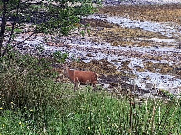 Plenty of deer and other fun in Rum here (but no more hills). |

A final look at the Cuillins of Rum from Mallaig.